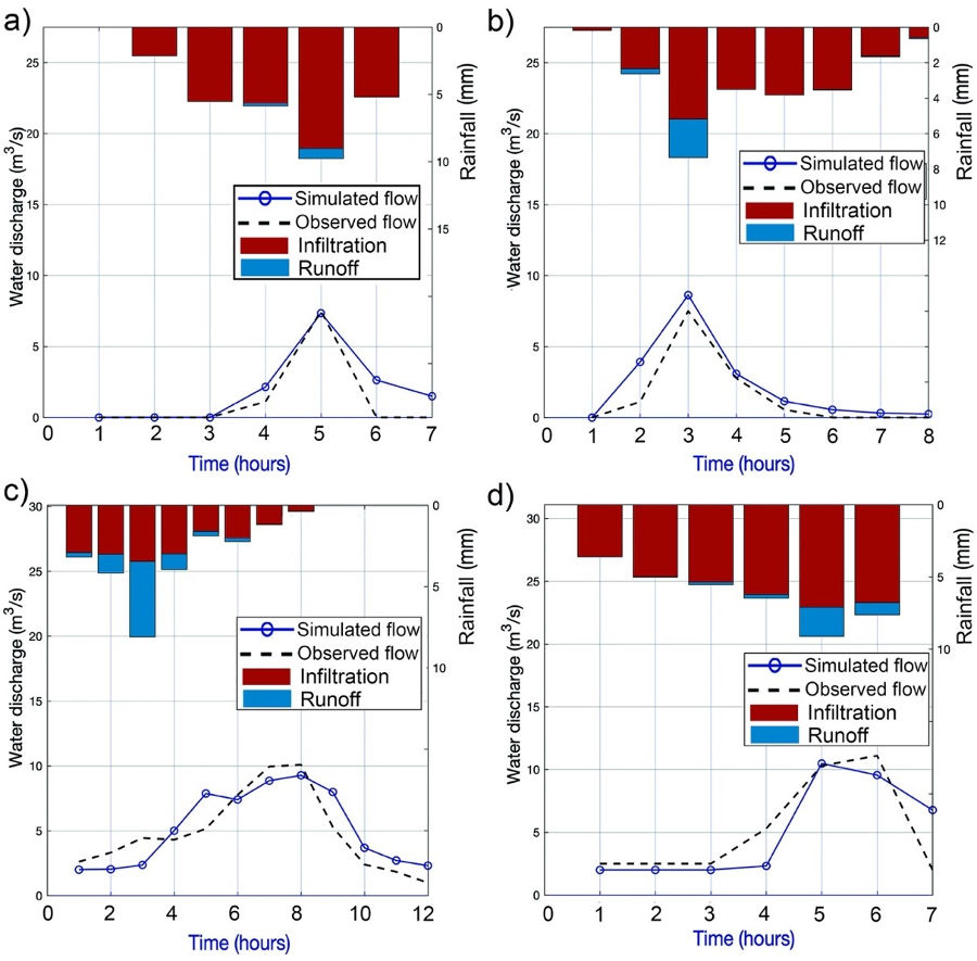
Understanding erosion and sedimentation processes along the drainage network, from hillslopes to rivers and reservoirs, is essential for water resources management and river restoration. This work proposes a novel dynamic evaluation of landscape factor from modeled runoff and erosion rates from physically-based distributed hydrological modelling, to estimate event-scale sediment connectivity. Four precipitation events of moderate intensity were selected and used for model calibration. The results were used to analyze the temporal variability of connectivity and comparison with indices based on catchment relief or land-uses. Although the headwater areas of the hillslopes presented similar values for all simulated events, a progressive increase in sediment connectivity, proportional to the runoff magnitude of the event, was observed. The variability of the event-scale connectivity index was mainly controlled by parameters related to flow (riverbed roughness, rill erodibility and particle diameter) and less by land use and vegetation cover (cover fraction or interrill erodibility). Although features affecting functional connectivity caused variations between events, the obtained results agreed with indices based on relief as landscape factor. This highlights the important role of structural connectivity represented by the catchment topography. However, the proposed methodology is subject to several sources of uncertainty related to event-scale model calibration, the erosion and transport processes considered and the spatial distribution of runoff. Furthermore, the geomorphological threshold for hillslope and rivers can also affect sediment connectivity, especially along the fluvial system. The results of this work highlight important future challenges in a more dynamic understanding of sediment connectivity river basins.